
Bridging Barne Barton: The Island Stories
Waterfront Barne Barton - 2017
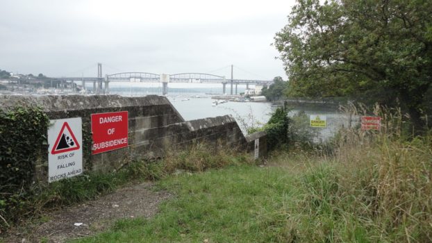
“A not-quite-public place called The Ledge: a stone, waterfront ledge in Barne Barton, nestled between the old stone gate of an MOD barracks and a creek at the peninsula’s edge. …
Read More →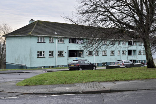
Roberts Road & Poole Park Road - 2016
Images copyright of Fotonow CIC © 2016
Read More →
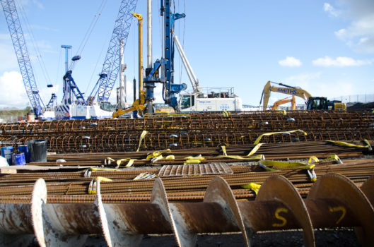
The Workers by Balazs Turos - 2013
Photographer Balazs Turos worked with Fotonow CIC on an Erasmus Internship in 2014 and documented the workers building the MVV waste to energy plant. His series The Workers was made …
Read More →
Building of MVV power plant - 2012
A Fotonow led youth project visited MVV construction site in 2012 to see the combined heat & power plant close up. images copyright Fotonow CIC © 2012
Read More →
Day in the life of a housing manager - 2009
We were sent a link to a really lovely article from 2009, conveying life in Barne Barton and also a mention of Melv Chislett, recently interviewed for The Island Stories), …
Read More →
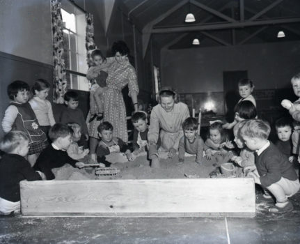
The Barn Playscheme 1994 - 1994
A photo from the collection of Kathy Cotton, Youth Worker in Barne Barton. Kathy’s photos document a timeline and history of youth and community work in the area.
Read More →Memories of working for the MoD in Barne Barton circa 1988 by Paul Rowse - 1988
Paul Rowse, Devonport Naval Heritage Centre Researcher and former Devonport Dockyard worker recounts the months he spent working at Roope Close Barne Barton. Click here to read the full account …
Read More →

‘Sabotage’, punk, the farmhouse Barne Barton, St Budeaux 1970s - 1977
Thank you to Mark Davis for giving his permission to share these photos of his punk bank Sabotage, playing their first gig at the farmhouse youth club. Mark and his …
Read More →
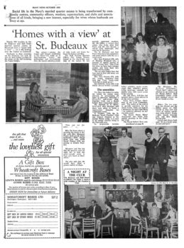
“Homes with a view at St Budeaux” - 1968
This edition of the Navy News, October 1968, looks at life for naval families on the estate, which it describes as “..among the largest and longest established in the Navy …
Read More →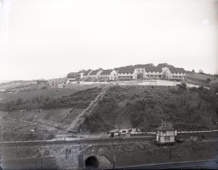
Building Barne Barton - 1965
Royal Naval Family Union - 1963
Images courtesy of The Box, Plymouth copyright The Herald
Read More →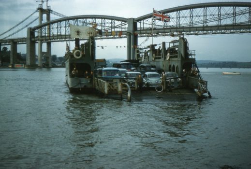
Last ferry crossing from Saltash over the Tamar River 1961 - 1961
Last ferry crossing from Saltash 1961.
Read More →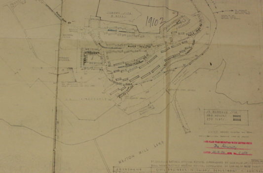
Bull Point Ratings Housing Estate - 1956
Bull Point Ratings Housing Estate – St Budeaux Site. Plans ‘Received by the Admiralty’ 1956 Plans submitted to the Admiralty 1956 to build 180 houses and 270 flats on St …
Read More →
Wilkinson Road - 1953
Bought on eBay by Fotonow CIC in 2018, the seller told us “The slides were bought many years ago, in Adelaide, South Australia, where I lived for 46 years. The …
Read More →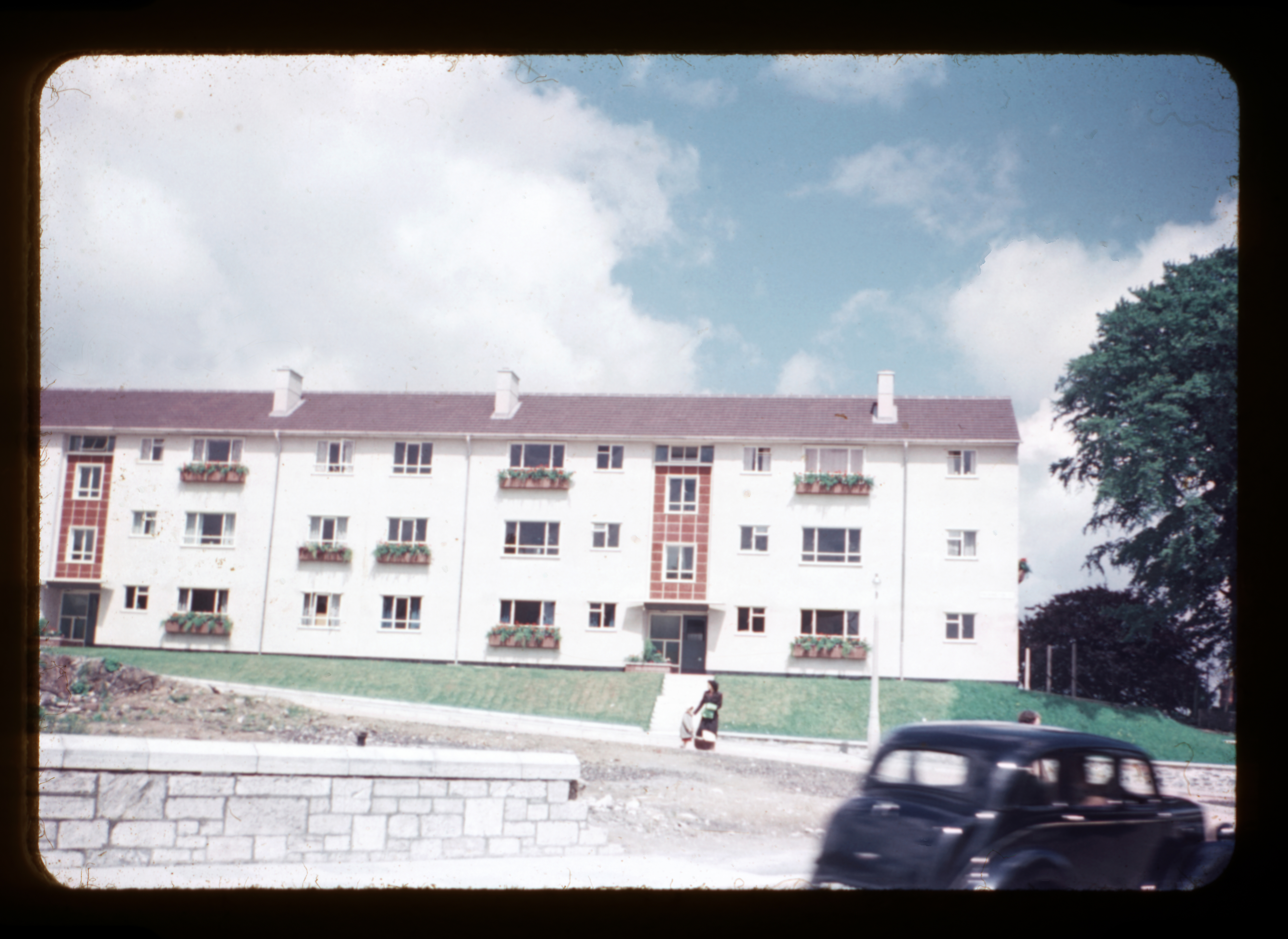

Ordnance Survey map - 1947
A map from 1947 with copyright to the National Library of Scotland.
Read More →
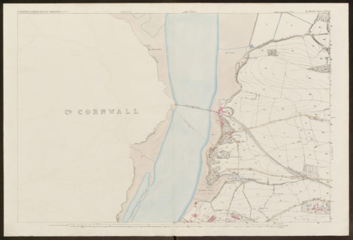
Ordnance Survey map - 1946
Map from National Library of Scotland, showing Devon and Cornwall boundaries as surveyed in the 1930s.
Read More →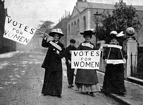
Emmeline Pankhurst arrested and brought to Bull Point Barracks - 1913
Emmeline Pankhurst is well known as the leader of the Suffragette movement, but her connection with and arrest in Bull Point, Plymouth in 1913 is less well known. Derek Tait …
Read More →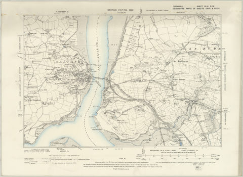
Map - 1896
A parish map from 1896 © National Library of Scotland
Read More →
Royal Albert Bridge - 1893
A lovely find in an old book ‘Rivers in Devon: From Source to Sea’ (Seeley & Co Ltd, London, 1893) the imposing Royal Albert Bridge at Saltash, drawn by A. Ansted, …
Read More →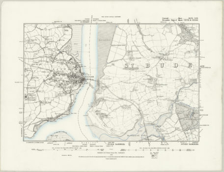
Local parish map - 1889
With thanks to The National Library of Scotland (all rights reserved) we have this wonderful map from 1889 showing Barne Farm in the St Budeaux parish. You can see Barne Barton is …
Read More →
The Hulks in Hamoaze and Royal Albert Bridge - 1868
The hulks in Hamoaze, with the Royal Albert Bridge in the background (Plymouth) from scan of illustration from the journal ‘The Graphic’, volume XVII, no 433, March 16, 1878.
Read More →
Early parish map - 1863
Early St Budeaux parish map from 1854-1863.
Read More →